2024
California Gnatcatcher Corridor Study
This project was designed to assess the quality of existing habitat and the connectivity of available open space in Oceanside, CA. Our assessment focused on habitat connectivity for the coastal California Gnatcatcher (Polioptila californica) in a portion of the City’s Wildlife Corridor Planning Zone.
The federally threatened coastal California Gnatcatcher is a year-round resident of coastal sage scrub habitats in Southern California. While previous work in this planning zone was successful at identifying stepping stones of habitat, land conversion continues to threaten the long-term successful movement of this species. This project, funded by Preserve Calavera, is a revitalized effort to conserve land and restore habitat to ensure this species can thrive in San Diego County.
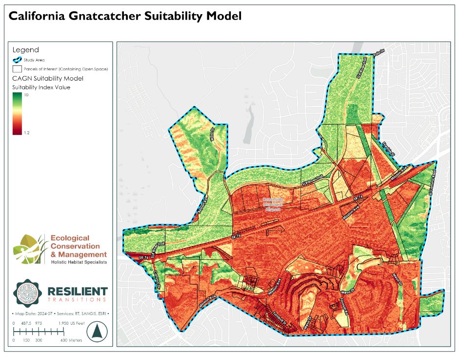
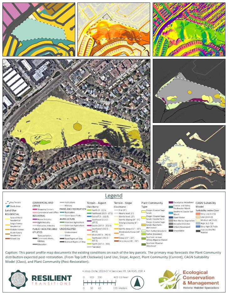
We developed a habitat suitability model that classified the landscape on a spectrum of low to high suitability. This modeling exercise highlighted the value that stepping stones of open space provide to wildlife in an urbanized landscape.
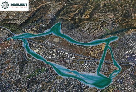
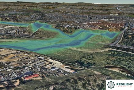
We also developed a wildlife corridor model and produced a series of visuals, illustrating how a gnatcatcher may traverse the study area. Our visuals provided the client with valuable insight into strong and weak connections in the planning zone, areas where potential barriers to movement exist, as well as locations where corrective actions can have the greatest impact to enhancing habitat connectivity.
This project is actively helping the City of Oceanside and the US Fish and Wildlife Service to prioritize restoration in the Wildlife Corridor Planning Zone.
In Collaboration with Ecological Conservation and Management, Inc.
Client: Preserve Calavera
Services: Spatial Analytics and Site Mapping, Landscape Design and Visualization
Role: Senior Spatial Scientist
Location: Oceanside, CA


